You are using an out of date browser. It may not display this or other websites correctly.
You should upgrade or use an alternative browser.
You should upgrade or use an alternative browser.
First snow of 2025. Central Indiana.
- Thread starter NEO 317
- Start date
ryguy80
Well-Known Member
Droning on and on...
Well-Known Member
- Joined
- Sep 1, 2024
- Messages
- 512
- Reaction score
- 542
- Age
- 64
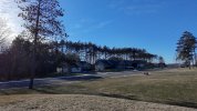
Further NW here in Wisconsin, there’s green grass! Taken from a Neo on my front porch.View attachment 1133
Yeah, but there's a ginormous blizzard blowing in from the left there, so run! Run like the wind!
Total snowfall so far. 166cm, but only 50cm on the ground. Less at Lake level. 1/2 of old (2000s) normal. Which was 1/2 of pre-2000 normal. Too many warm days and rain. Lake Effect snow and Lake Effect warmth. Coldest nights of the year this past week, but 10 to 15F warmer than Minneapolis/St.Paul 3 degrees latitude S of here.
Awoke to a nice powder day last Saturday. Attached image. NWS forecasted only 4inches/10cm. 12"/30cm and still snowing when I left to the ski area. Ultra light powder. Easy to drive through if you have 4x4 and ground clearance. Nothing shuts down up here. Just another winter day. It more or less lightly snowing until late last night. Today -5C/23F, blue sky, zero wind. But Neo crashing into the new snow would have been a pain to find. Years ago lost a small quad in the snow. View was solid white. No help in locating. Found it next Spring by sheer luck. Rain forecasted next Monday/Tuesday. 40sF. Not good.
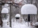
Awoke to a nice powder day last Saturday. Attached image. NWS forecasted only 4inches/10cm. 12"/30cm and still snowing when I left to the ski area. Ultra light powder. Easy to drive through if you have 4x4 and ground clearance. Nothing shuts down up here. Just another winter day. It more or less lightly snowing until late last night. Today -5C/23F, blue sky, zero wind. But Neo crashing into the new snow would have been a pain to find. Years ago lost a small quad in the snow. View was solid white. No help in locating. Found it next Spring by sheer luck. Rain forecasted next Monday/Tuesday. 40sF. Not good.

RcHawks
Well-Known Member
- Joined
- Sep 7, 2024
- Messages
- 385
- Reaction score
- 333
We've gotten snow in the last few days, not to bad compared to the last one. Sixteen inches last time and we have maybe four or five inches in the lastest round, but it was and is the windchill that's so bad. Three days ago windchill was -30 degrees F.
The ridge and "mountains" trap the Lake Effect warmth. Inland side the temperatures were way too cold. Actual air temps way below -20C/-4F. Windchill is painful. Will take a sunny, zero wind, and 0F over a -30F windchill any day. This time of year the radiant warmth of sun is relatively intense. -8C/+18F @ 0929 and the snow is melting and dripping off the S facing roof.
For me still too cold to fly outdoors even if I had a tx glove box. Sunny, minimal breeze, and warmer than -2C is my limit. I'm a wimp.
Safe ice actually has formed on the bays and coves this year. First time since ???? Ice fishing people using their ATVs and snowmobiles a good mile or two out. Should be nice Spring on the ice flying conditions. Ice pressure ridges starting to form.
Last edited:
Driving car in the snow is a lot of funI like the snow for pictures, but not much else.
Droning on and on...
Well-Known Member
- Joined
- Sep 1, 2024
- Messages
- 512
- Reaction score
- 542
- Age
- 64
I like the snow for pictures, but not much else.
I like the snow a lot, for recreation (skiing, snowmobiling, et. al.), the beauty, holiday change of pace.
That's likely because I don't live where it snows, but visit.
RcHawks
Well-Known Member
- Joined
- Sep 7, 2024
- Messages
- 385
- Reaction score
- 333
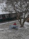
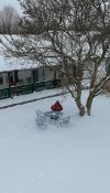
I flew the NEO when the winter storm was arriving and then the following day.
The innocent single Snowflake is pretty, but when they gang up on ya', there's plenty of shoveling ahead.
.View attachment 1129View attachment 1130
I dig the before and after pic!
.

