For general information: in Brazil ANAC/DECEA (National Civil Aviation Agency - Department of Airspace Control) determines these distances and height from airports and heliports.
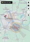
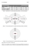
The colored map is of my city, and black map is the law.
The colored map is of my city, and black map is the law.


